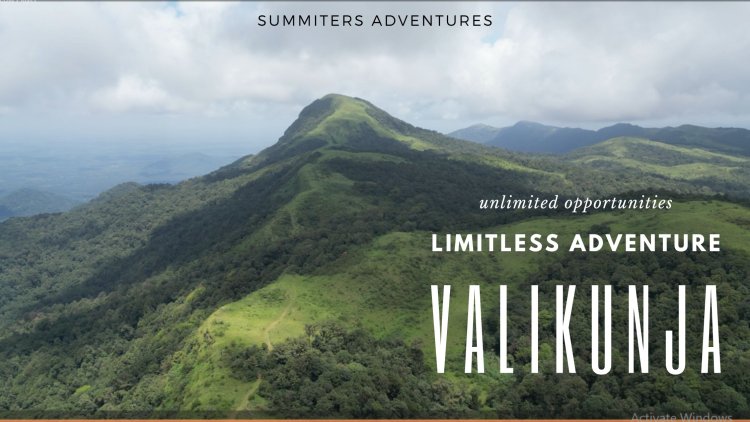
Kudremukh National Park Adventure
⛰️ Valikunja Trek
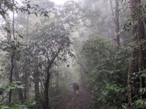
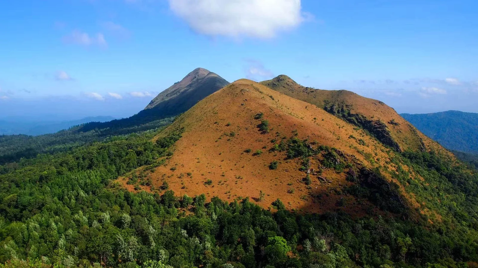
Embark on a thrilling journey through dense forests, steep climbs, and unique rock formations in Kudremukh National Park
3,570 ft
Peak Elevation
16–18 km
Distance
6–8 hrs
Duration
Moderate-Difficult
Difficulty
12+
Minimum Age
Oct–Feb
Best Season
Trek Overview
Your adventure starts here

- Starting Point: Kerekatte Forest Office, ~38 km from Sringeri
- Elevation: 3,570 ft (1,089 m)
- Trek Distance: ~16–18 km round trip
- Duration: 6–8 hours
- Difficulty: Moderate to difficult (steep final climb)
Highlights & Attractions
Nature's finest moments

- Unique rock “footprints” linked to Vali from Ramayana
- 360° views of Kudremukh, Sringeri, and Western Ghats
- Pristine, remote forest trail with minimal crowds
- Thrilling 70° summit climb
Permits & Rules
Essential information

- Mandatory Permit: Obtain from Kerekatte Forest Office
- Group Trekking: Highly recommended; solo not advised
- Trek Timings: Start by 9 AM; turn back by 1:30 PM
- 🚫 No plastics, alcohol, or campfires allowed
How to Reach
Getting to the trailhead

- By Road: ~2 hr drive from Chikkamagaluru + 40 min 4×4 ride
- Transport: Own vehicle or hired jeep from Sringeri
- Accommodation: Homestays/dorms near Sringeri or Kerekatte
Photo Gallery
Capture the journey
Why Choose Henjodi Stores?
We simplify your trek
- ✅ Local expertise with years of trekking support experience
- ✅ One-stop for permits, food, jeep rides, and guides
- ✅ Flexible packages - Contact us for current pricing
- ✅ Genuine Malenadu coffee, tea, and local snacks
- ✅ Friendly, local support team available via WhatsApp
Trekker Insights
What others say
"The steep summit climb was challenging but worth it for the views and rock formations!"
Experienced Trekker
5/5 Stars
"Dense forests and wildlife sightings made this trek unforgettable!"
Wildlife Enthusiast
4.5/5 Stars
Frequently Asked Questions
Suitable for fit beginners with some trekking experience due to the steep summit climb.
Wear leech socks, apply Dettol/saline on shoes/socks, and check frequently during monsoon.
No facilities on the trail; carry all food, water, and essentials from the base.
Highly recommended due to wildlife and trail isolation; solo trekking is not advised.